A recent article by New York Times columnist and linguist John McWhorter deals with the way Black American English is becoming a language option available to everyone, of whatever ethnic background. (True that, John). In the course of the article he mentions in passing that regional accents are very weak in the US in comparison to elsewhere.
Irish regional accents, on the other hand, are one of the glories of humanity. The late actor June Whitfield, well known for her facility with accents, was once asked to sound Ulster, so she took on the Antrim burr common in north Belfast. The director then asked her to soften it to something from Bangor in Co. Down. She asked ‘Which street in Bangor?’
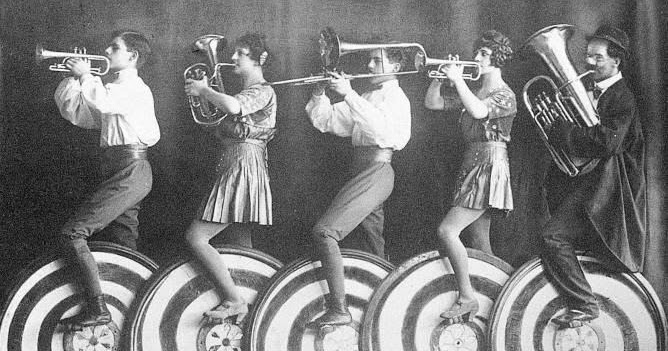
Struggling with them Cork city vowels, boy?
All of which led me to realise that Irish regional accents must also be one of the banes of pre-literate record-keeping, and that Americans researching Irish records are unlikely to be aware of the extent to which accents may have coloured and distorted what they’re looking for.
Just as “tea” becomes “tay” in the West, Keane becomes Kane, Deane becomes Dane, Heaney becomes Hayney… As eggs are laid by “hins” in south Roscommon, so Lenihan becomes Linihan and Grenham, Grinham. Slavin becomes Slevan and Sugrue becomes Shoughroe and Geehan becomes Guiheen and in Belfast, Lane becomes “Leayen” and Strain becomes “Streayen”.
I could go on. One thing almost all these distortions have in common is that the culprits are vowels, because vowels are where most accents live. So to get a sense of what’s possible, take out the vowels from the surname you think your ancestors had and substitute them with wildcards. Have a go here.
A Belfast newsreader on Ireland’s RTÉ gives me a little thrill every time she says “reayin”. Given the weather here, she has to say “reayin” a lot. Lucky me.
Recently a friend with no interest in genealogy (a “civilian”, to use the technical term) started sending me screenshots and links from the “British Royal Family History” website. He spent his early years in an English primary school and I sniff resurfacing imperial indoctrination.
Gawd armi’ty!
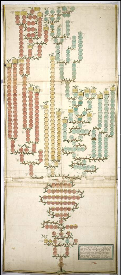
The pretext for sending them is awe at the sheer scale of the trees, but also at the legitimacy implied in that unbroken line of inheritance. Hmm. As a card-carrying Irish peasant begrudger, I can’t help noticing all the little gaps and hiccups. William the Conqueror sits there beneath the Anglo-Saxon Aelfreds and Ethelreds with no family connection whatsoever. I suppose the clue lies in the “Conqueror” bit.
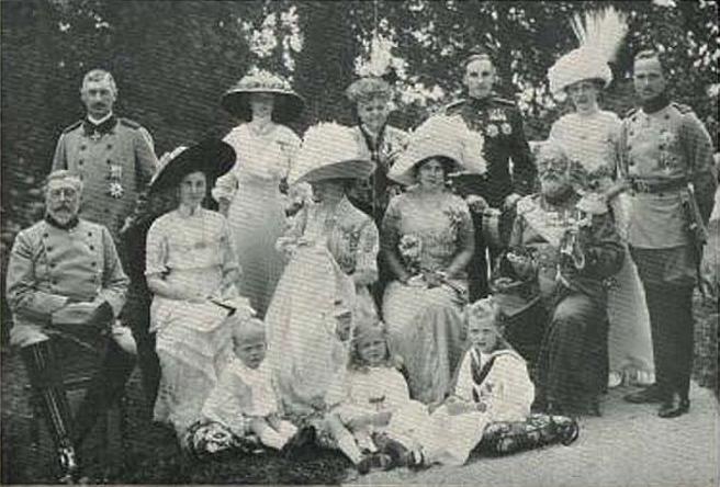
William’s descendants, in-laws and distant cousins slaughtered, invaded and usurped each other for many’s the happy century thereafter. I particularly like the way James I cunningly got one of his great-grandfathers to marry the sister of Henry II, thus scooping the throne a century later.
But the grand prize for rebranding must go to the “Glorious Revolution”. Because the royal inheritance lottery had thrown up a prize they disliked, the entirely dislikeable James II, the Great and Good of England ignored the rules of inheritance and ultimately slipped the monarchy to a biddable, non-English-speaking, minor German toff, George I, whose only claim was one Scottish granny. Hence the current lot, the Glorious Saxe-Coburg-Gothas of London and Netflix.
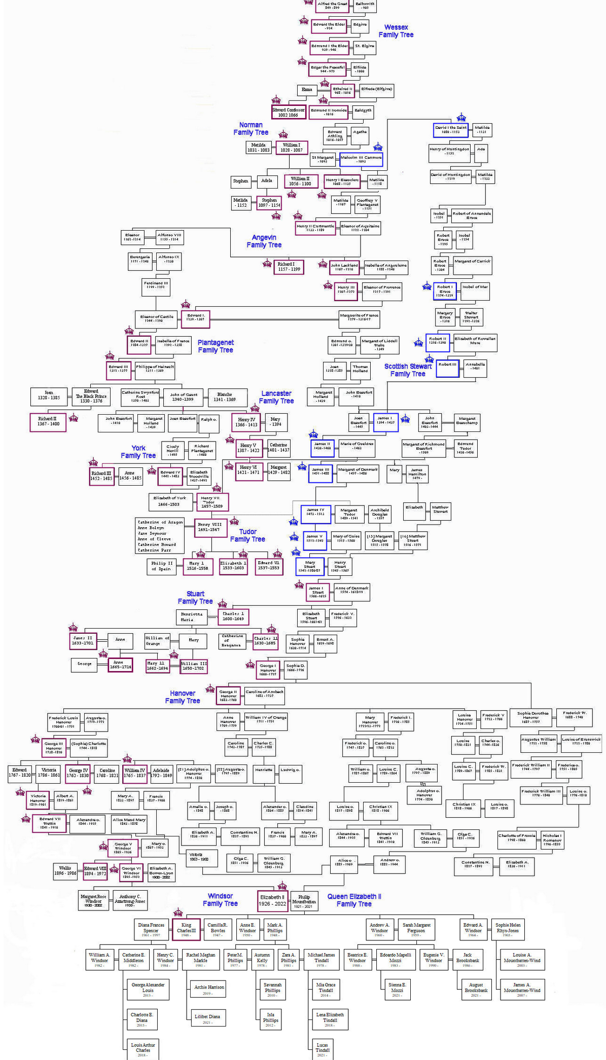
Some Saxe-Coburg-Gothas
So the secret to passing on the crown appears to be judicious cousin marriage. I imagine being able to keep a straight face when talking about the divine right of kings wouldn’t hurt either. Have a look at some of the alternative, equally legitimate claimants.
Hold that straight face, Louis
Fun as it is to jeer at the neighbours, we have our own pedigree problem.
Where the Brits have only had (more or less) one royal family, we had hundreds of the damn things. Early medieval Ireland was plagued with dozens upon dozens of shifting little statelets, tuatha, each with its own elaborate aristocracy and royalty. Many of their boundaries were mapped by the English later, but they had problems describing them. They couldn’t be kingdoms, because that would make them equivalent to their own yoke across the Irish Sea. A few levels down the pecking order were Norman barons, consiglieri rather than capo di tutti capi, so they were picked as an equivalent for Irish kingdoms. The tuatha became baronies. Let’s be clear: as geographic entities, baronies exist nowhere outside Ireland and have no barons.
Having to keep track of so many aristocratic pedigrees propelled genealogists into the front rank of medieval Irish society (ahem) but also meant that huge numbers of people could claim royal descent. And they did, loudly and often. One of the Anglo-Irish stereotypes of the peasant Gaels was that every labourer in the field claimed to be descended from princes and kings. In truth, many were. And of course, many weren’t, because most of the traditional genealogies were packed with convenient political lies. A bit like the Saxe-Coburg-Gothas.
Add in the fact that after forty generations, a thousand years or so, a direct descendant of William the Conqueror will on average share 0.0000000001% of William’s DNA and the moral is that impressive pedigrees mean diddly-squat. In the immortal words of the bogus McCarthy Mór, we all remain “ignoble and enjoy neither place, position, nor gentility”.
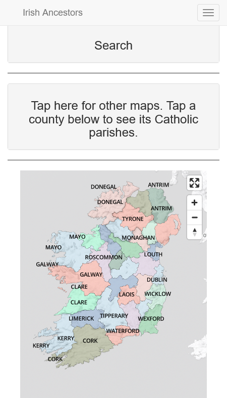
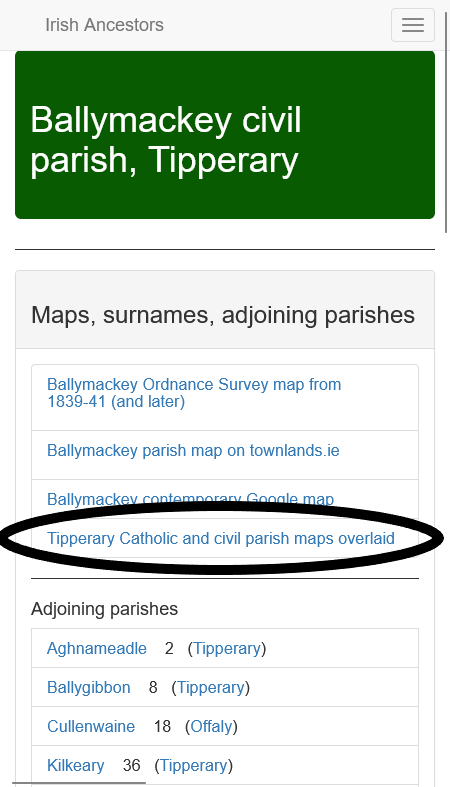
We just put up much-improved maps of the Catholic parishes of Ireland, the usual all-singing, all-dancing, zoomable, click-through, will do your laundry on request, with a nice auto-complete search. Have a gander.
Nice though they are, that’s not what this post is about. I want to confess where the maps came from.
They got them from me. When planning to digitise the parish register microfilms, they asked to use the maps published in Tracing your Irish Ancestors and (at that time) on the Irish Times site. I said yes and provided advice and they picked up on some of the mistakes in the maps for me to correct. Win-win.
But where did I get the maps?
Shuffles. Looks at shoes. Back in 1991, when I was putting together the first edition of the book, I thought a killer selling point would be Catholic parish maps. Nothing like them existed, at least not for the entire island, and I knew from bitter experience that trying to work out the position of adjoining Catholic parishes one-by-one by using the underlying civil parishes was frustrating and headwrecking and not always possible.
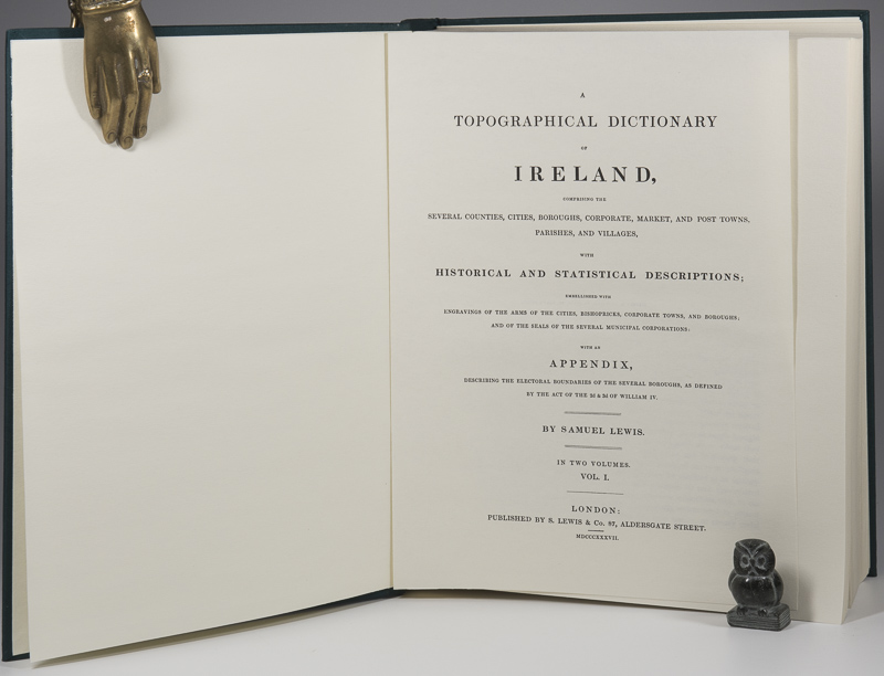
But the only nineteenth-century source for the geography of Catholic parishes was and is Samuel Lewis’ Topographical Dictionary of Ireland (1837). Lewis was resolutely Anglican and his coverage of Catholic parishes could be a tad grudging, with offhand comments along the lines of “the [civil] parish is divided between the two RC parishes of Ballythis and Ballythat”. And sometimes he just ignored the bloody papists altogether.
To be fair, for most papist Catholic parishes Lewis does give clear enough direction, making it possible to use existing civil parish boundaries to trace the Catholic outlines. But for around thirty per cent or so, there is no clear direction.
What to do? Once you start to draw the things, it becomes clear from the gaps where some parishes must be. But for those incorporating parts of multiple civil parishes, it’s just not possible to say with any accuracy where inside those civil parishes the Catholic border should go.
After wrestling with my conscience and winning, I simply took my pencil and drew lines where they looked most probable. As a salve to my sulking conscience, the original published maps came with loud disclaimers, saying they were not geographically precise and were there only to show the positions of parishes in relation to each other. Somehow the disclaimers fell off the back of the lorry transporting the maps to NLI.
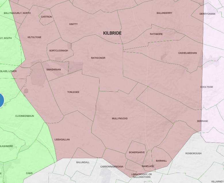
KIlbride Catholic parish in Roscommon. Showing why I didn’t want to overlay RC on townland maps
Hence my enduring reluctance to overlay the RC maps on the townland maps.
But I’ve just done it anyway. If you want to get a sense to just how geographically arbitrary some of the boundaries can be, have a look at a new feature, in beta, that takes RC and civil parish maps and allows you to swipe between them and zoom in on the underlying townlands. Here’s Tipperary for example, civil to the left, Catholic to the right. I promise, the more you zoom in, the more your hair will stand on end.
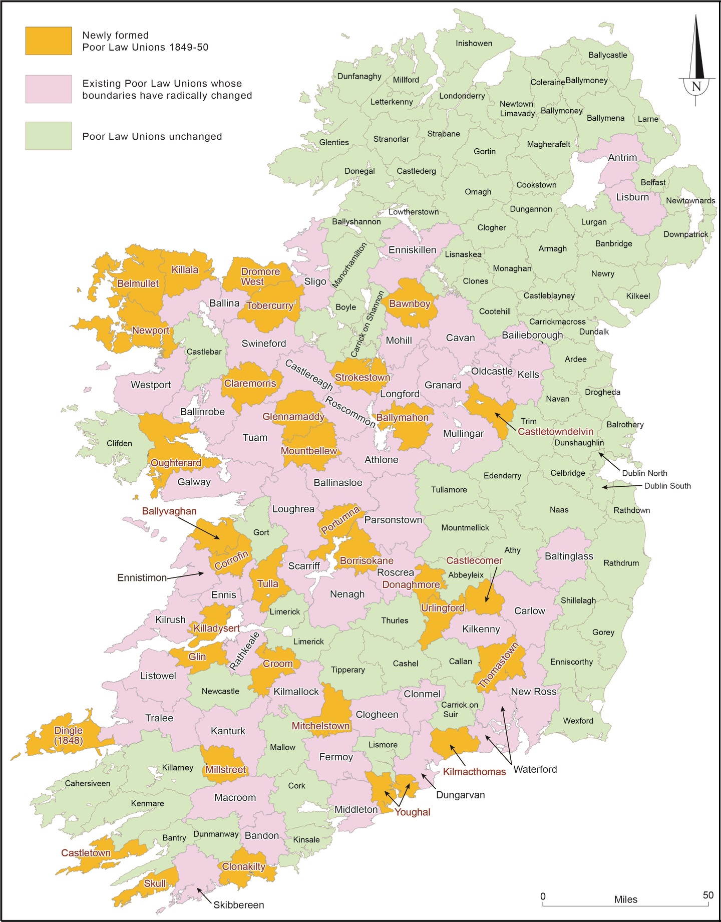
Poor Law Unions are the geographical areas used to collect records of births, marriages and deaths in Ireland. They are still today, astonishingly, based on the old Victorian welfare system. Of course we had to map them.
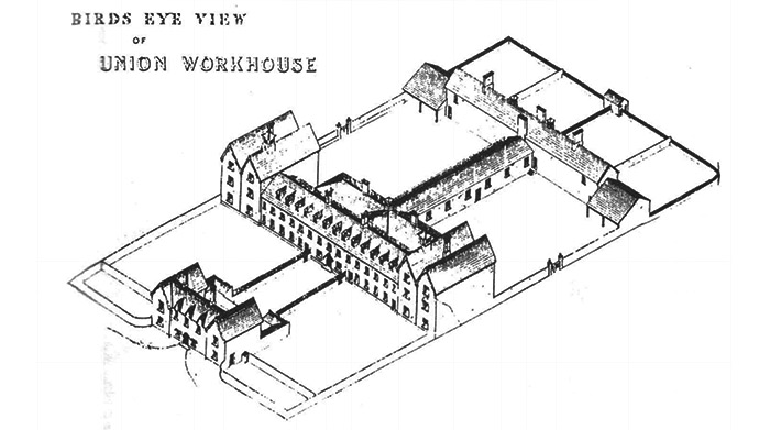
The standard workhouse template
The Irish Poor Law Act of 1838 divided the island into 130 districts, each with a workhouse at its heart, usually situated in the largest local market town. A property tax was levied to pay for the operations of the workhouse, so the primary rationale for the area covered was that it should produce the necessary tax take. As a result many Unions ignored existing parish and county boundaries, unlike their English equivalents.
By 1852, the Famine had pushed the system to breaking point and new Unions were carved out of the existing districts, particularly in the south and west, where public hunger and distress had been at their most intense. For Irish genealogy, the direct relevance of the Poor Law begins in 1864, when the Victorian public health system based on the Unions took on state registration of births, marriages and deaths. A typically rigid hierarchy ran the whole thing. Local registrars collected registrations in subdivisions of the Union and passed them to the Superintendent Registrar in charge of the each Union, who made copies and passed them on in turn to the Registrar General in Dublin.
The locations given are the Poor Law Unions
When centralised annual indexes were created by the Registrar General for all Irish births, deaths and marriages, the Poor Law Unions were the placenames used in the indexes: they are the locations that appear in the indexes online at IrishGenealogy and FamilySearch. Because most of them cover cross county and parish boundaries, they can be very deceptive.
Egregious examples: Edenderry Union includes parts of counties Kildare, Meath and Offaly, even though Edenderry town is 100% Offaly. New Ross, in Wexford, also covers bits of Carlow and Kilkenny. Ballyshannon takes in equal parts of counties Donegal, Leitrim and Fermanagh, Waterford Union includes most of south Kilkenny …
The point is that the system makes it all too easy to search for your ancestors in the wrong location. Hence the maps.
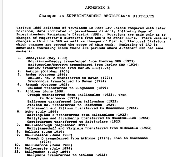
The townland lists used on to create the maps come from a marriage of the 1851 Townlands Indexto the 1885 collection of pamphlets Townlands in Poor Law Unions, produced by the Registrar General to let local registrars know which areas they were responsible for. The pamphlets were collected and republished in book form in 1997 by the late, great George Handran, and republished on CD-ROM by Eneclann in 2006. There were significant changes and reoganisations of the local registrars’ districts over the years, with most of them detailed in George’s book. Dissolved unions (for example, Donaghmore) are identified on our maps, but all of the maps have to be taken as snapshots of an evolving system. Again, George supplies all the nitty-gritty.
A tiny snippet of George’s nitty-gritty
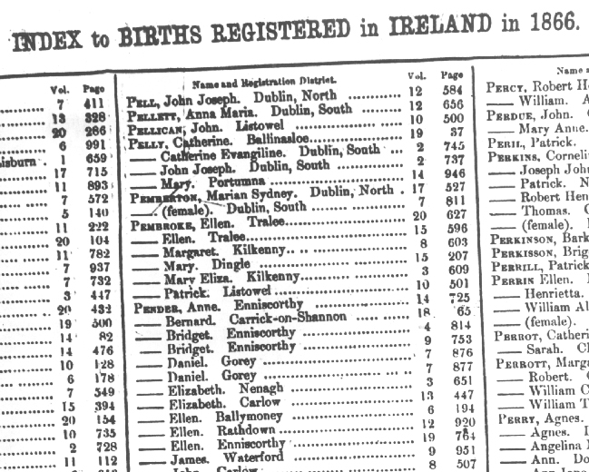
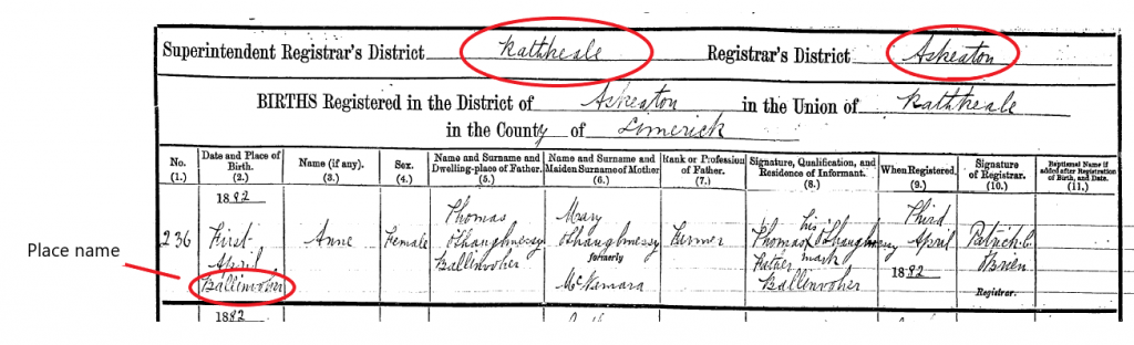
The usefulness of having searchable place names from the the Superintendent Registrar’s Districts and the local registrars’ districts lies mainly in identifying the places given in the original registrations. Standard spellings were not used and the handwriting can be fiendish. All registrations include both PLU and local registrar’s district, narrowing the possibilities. An example:
Illegible birthplace, with PLU and registrar’s district clearDone and dusted
Poor Law Unions are the geographical areas used to collect records of births, marriages and deaths in Ireland. They are still today, astonishingly, based on the old Victorian welfare system. Of course we had to map them.
The standard workhouse template
The Irish Poor Law Act of 1838 divided the island into 130 districts, each with a workhouse at its heart, usually situated in the largest local market town. A property tax was levied to pay for the operations of the workhouse, so the primary rationale for the area covered was that it should produce the necessary tax take. As a result many Unions ignored existing parish and county boundaries, unlike their English equivalents.
By 1852, the Famine had pushed the system to breaking point and new Unions were carved out of the existing districts, particularly in the south and west, where public hunger and distress had been at their most intense.
For Irish genealogy, the direct relevance of the Poor Law begins in 1864, when the Victorian public health system based on the Unions took on state registration of births, marriages and deaths. A typically rigid hierarchy ran the whole thing. Local registrars collected registrations in subdivisions of the Union and passed them to the Superintendent Registrar in charge of the each Union, who made copies and passed them on in turn to the Registrar General in Dublin.
The locations given are the Poor Law Unions
When centralised annual indexes were created by the Registrar General for all Irish births, deaths and marriages, the Poor Law Unions were the placenames used in the indexes: they are the locations that appear in the indexes online at IrishGenealogy and FamilySearch. Because most of them cover cross county and parish boundaries, they can be very deceptive.
Egregious examples: Edenderry Union includes parts of counties Kildare, Meath and Offaly, even though Edenderry town is 100% Offaly. New Ross, in Wexford, also covers bits of Carlow and Kilkenny. Ballyshannon takes in equal parts of counties Donegal, Leitrim and Fermanagh, Waterford Union includes most of south Kilkenny …
The point is that the system makes it all too easy to search for your ancestors in the wrong location. Hence the maps.
The townland lists used on to create the maps come from a marriage of the 1851 Townlands Indexto the 1885 collection of pamphlets Townlands in Poor Law Unions, produced by the Registrar General to let local registrars know which areas they were responsible for.
The pamphlets were collected and republished in book form in 1997 by the late, great George Handran, and republished on CD-ROM by Eneclann in 2006. There were significant changes and reoganisations of the local registrars’ districts over the years, with most of them detailed in George’s book. Dissolved unions (for example, Donaghmore) are identified on our maps, but all of the maps have to be taken as snapshots of an evolving system. Again, George supplies all the nitty-gritty.
A tiny snippet of George’s nitty-gritty
The usefulness of having searchable place names from the the Superintendent Registrar’s Districts and the local registrars’ districts lies mainly in identifying the places given in the original registrations. Standard spellings were not used and the handwriting can be fiendish. All registrations include both PLU and local registrar’s district, narrowing the possibilities.
An example:
Illegible birthplace, with PLU and registrar’s district clearDone and dusted
The more we immerse ourselves in the online maps, the clearer it becomes that all maps are provisional. Two dimensions can never truly embody four. Contour lines and hill-shading might approximate the third dimension, but the fourth, time, is always out of reach. Every map is only a snapshot of a moving train.
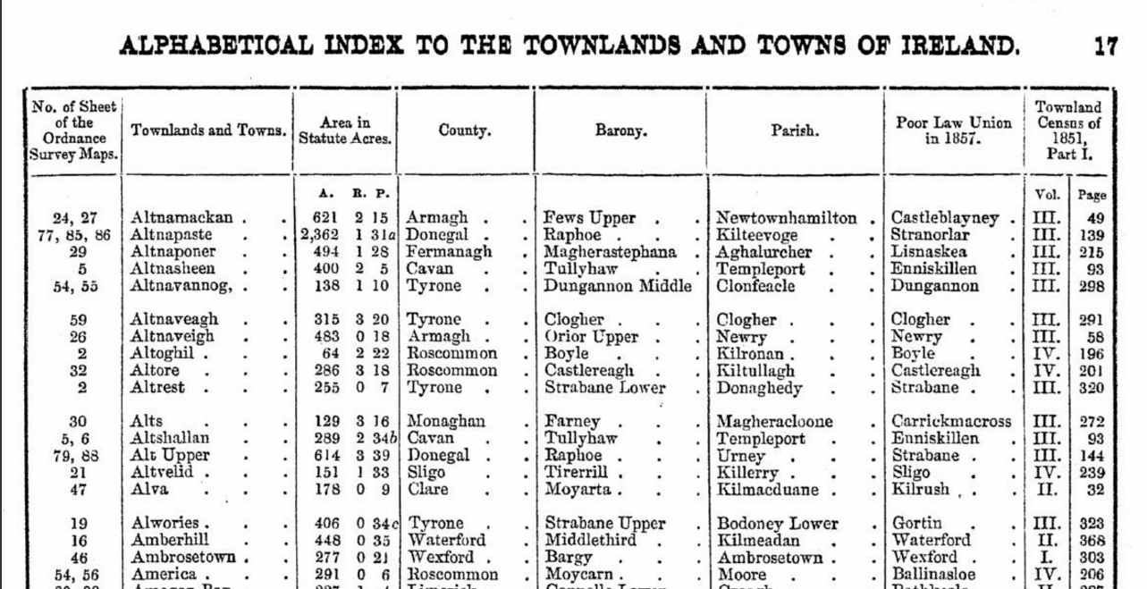
What prompted such fortune-cookie musings is growing awareness of the disparities between the place-names listings on the site and the new maps that represent them. The listings are based on the 1851 Townlands Index, which reproduces the standardised place-names used for the 1851 census. These standard versions were created by the Ordnance Survey between 1831 and 1841 and were also used by Griffith for the Primary Valuation. The problem is that some of the Ordnance Survey parish boundaries in the Index had changed by the time Griffith came surveying.
Accurate in 1851
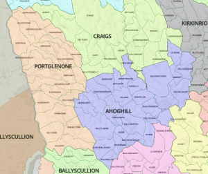
The most egregious example is the parish of Ahoghill in Antrim. In the 1851 Index, this consisted of a huge area, almost 150 sq km, roughly 60 square miles. By the time Griffith’s surveyors arrived in the late 1850s, it had been divided in three, Ahoghill, now down to c. 50 sq km/20 sq m, Craigs (51 sq km) and Portglenone (44 sq km).
So, do we stick with the 1851 listing and break the connection to the Griffith’s records? Or mess with the 1851 to make it fit Griffith? The aim of the site is to provide tools and shortcuts for research, not to reproduce prefect facsimiles, so there can only be one choice. Messing and Griffith’s it is.
The Antrim map is already rejigged to represent the 1861-62 Griffith’s survey. Now we just have to pick apart all the record listings for Ahoghill and reknit them into the three smaller parishes. Argh.
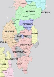
Ards penisnusla
Because Griffith’s was published relatively early (1847-1854) for southern counties, with Ulster counties appearing in the 1860s, the areas most affected by the discrepancies are in Derry, Fermanagh, Antrim and Down. Parishes on the Ards Peninsula in Down appear to have been shuffled crazily in the 1860s, with the mapped areas bearing very peculiar relationships to the listings. There are many, many townlands mapped into one parish, but recorded in another in the Valuation.
We’ll correct the worst offenders over time, but in many cases the effort is pointless. It’s also not clear that some of the parishes scattered in multiple parts on the maps are entirely accurate, at least for Griffith’s. So sup with a longish spoon and gird your loins with that trusty genealogical scepticism.
(A quieter caveat is that we’ve finally implemented the soft paywall for the maps. In the first flush of enthusiasm we forgot about it.
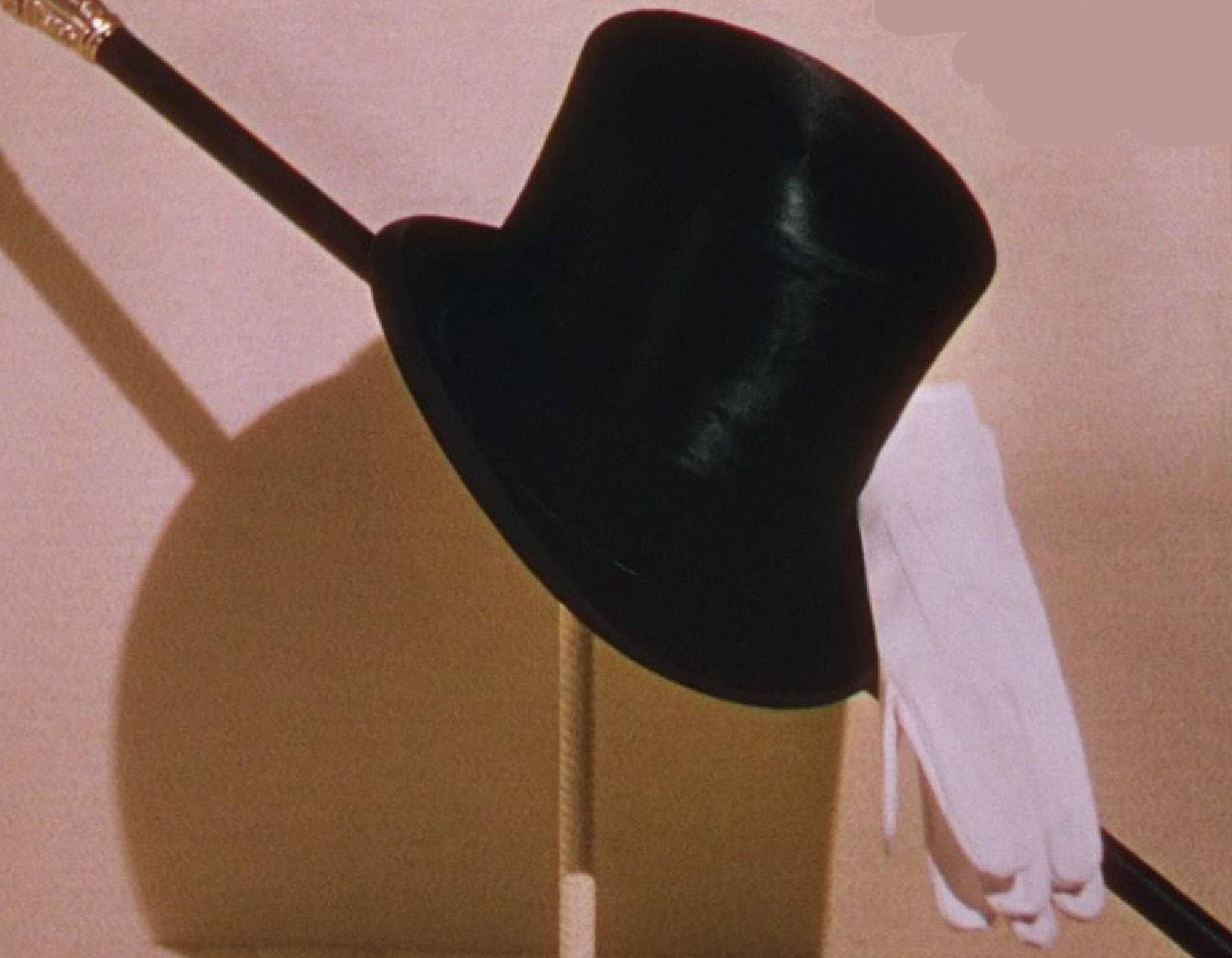
After putting up the all-singing, all-dancing, click-and-zoom civil parish maps in July, it occurred to us that the townlands available from Open Street Map (townlands.ie) would fit nicely into them. If we just could get the data down to manageable file-sizes. So we squeezed and squeezed and … Whoopee. All-singing, all-dancing, and now break out the top hat and cane.
Then, after repeatedly hunting inside various parish maps for a townland, we thought it would be nice if you could just click on the townland name to drop a marker showing exactly where it was. So we did that. Yeehaww. All-singing, all-dancing, add white gloves to the top hat and cane.
Ballyevenmore
But that only worked if the townland names on the maps matched those in our own listing. And in about 10% of cases, more than 6,000 names, they didn’t. As my Auntie Breda used to say, it would give you a pain in your Laladooshia. But there was no choice. At the end of July, we began the process of standardising the names, one by irritating one. There were plenty of typos in the OSM lists and (mumbles) one or two in our own. Many came down to commas and brackets and hyphens. The standard we aimed for was the Griffith’s spelling, so no Irish-language versions are included, and nothing later than the 1860s. This is where the differences between OSM and ourselves came into play: They aim for contemporary geographical accuracy; we just want to make it easier and more intuitive to get at the records.
Anyway, that process ended last week, with about 98% of place names now plonking down markers when you click them.
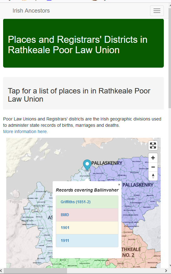
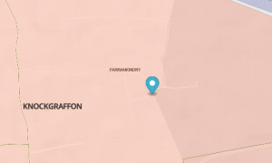
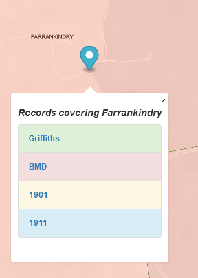
Then the fact that the markers were unclickable began to annoy me. Don’t just sit there, you lazy little marker, do something. So I made a popup from the marker to include links to records covering that townland: Griffith’s, civil BMD records, 1901, 1911. Wahey, the circus is in town.
What this means is that for 98% of townlands in rural Ireland, you can now click through to the universally relevant records from the 1850s to the 1920s, while seeing the location of each townland in relation to its neighbours. A historical snooper’s dream: in other words, mine. Enjoy.
(In the course to the eyeball-to-eyeball engagement with the townlands, I came across some doozies. Here, for your delectation, are a few of my favourites:
America and Liberty, just across the fields from my ancestral homeplace, probably testament to local eighteenth-century support for the American Revolution.
Irish civil parishes are strange beasts. For good or ill, knowing about them is essential for Irish research.
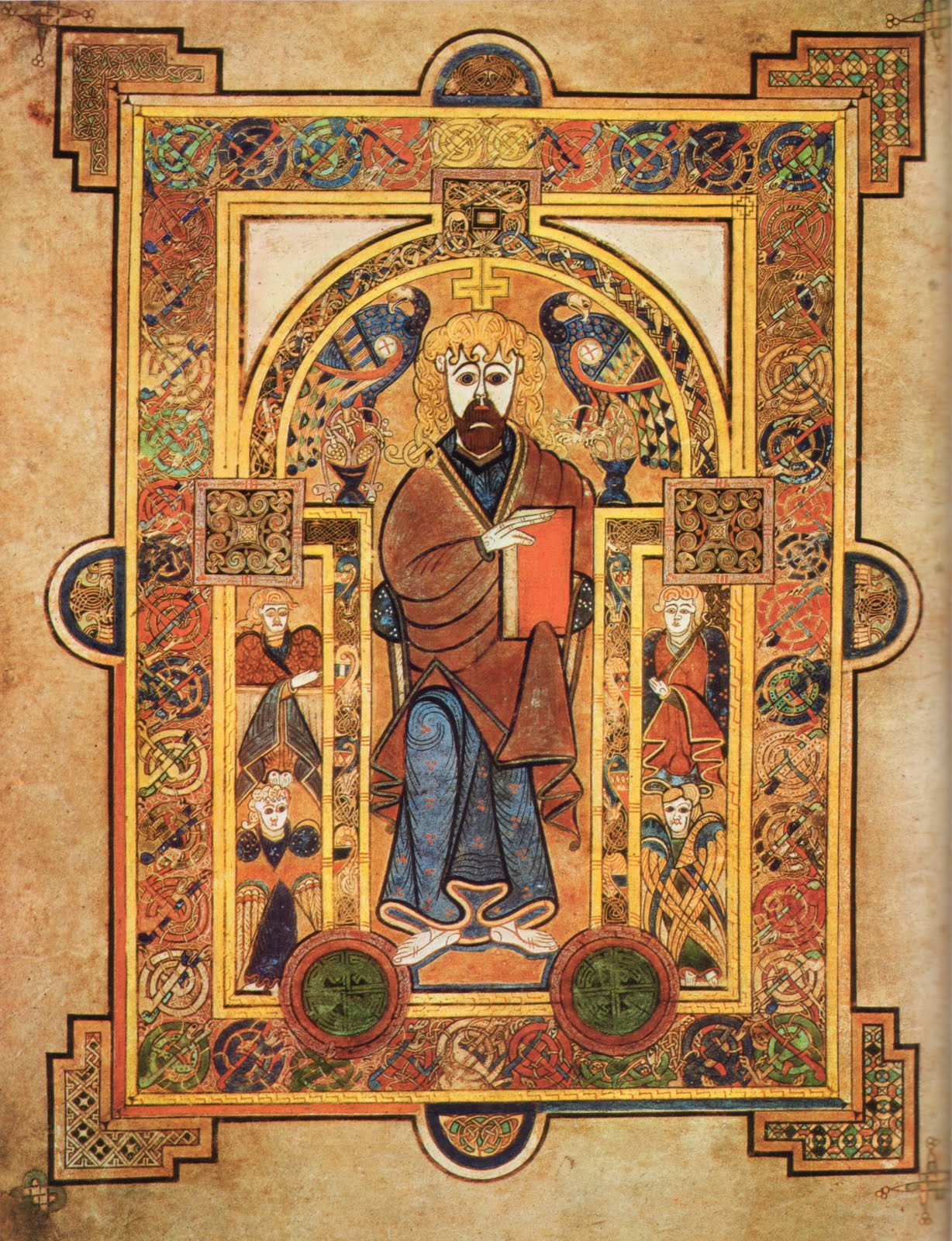
They came into existence, as simple parishes, after the twelfth century attempt to tame the exotic Irish church and bring it into line with Roman norms. As well as having scandalous marriage laws, outrageous hairstyles, deadly book illustrators and a peculiar way of calculating the date of Easter, the early Irish church disregarded the Imperial Roman territorial divisions of parishes and dioceses. We preferred vast monastic holdings that resembled secular kingdoms in power and wealth, and were passed on, like kingdoms, from father(-Abbot) to son(-Abbot).
Deadly book illustration
We eventually had clerical celibacy, parishes and manners put on us by the Anglo-Normans.
Until the sixteenth century, however, parishes were only in widespread use in the English-controlled areas of the East. The Reformation in Tudor England transformed the Church there into an arm of the state, and then they conquered the entire island. As a result, a parish structure was finally extended country-wide and became the bailiwick of the Anglican Church in Ireland, the Church of Ireland. Because church and state were so intertwined, these parishes then also became the geographic basis of public administration, hence “civil” parishes. For two centuries from roughly 1700 to 1900, tax records, militia levies, rentals and censuses were all based on the civil parish.
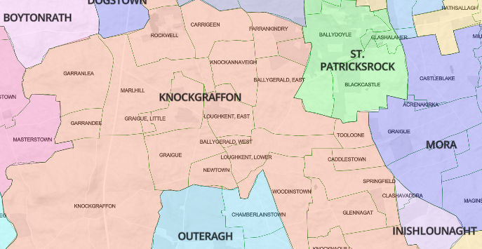
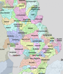
Why bring this up now? Because we’ve just implemented a major upgrade to the civil parish maps on this site. Maps were always important, because you need to know where the blasted parishes are, as well as what townlands they contain and which other parishes adjoin them. But the old maps were a little … underwhelming. With the new ones, you can zoom in and out, see where the constituent townlands are and best of all enjoy the whole thing in glorious Candy-Crush colour.
Candy-Crush Antrim
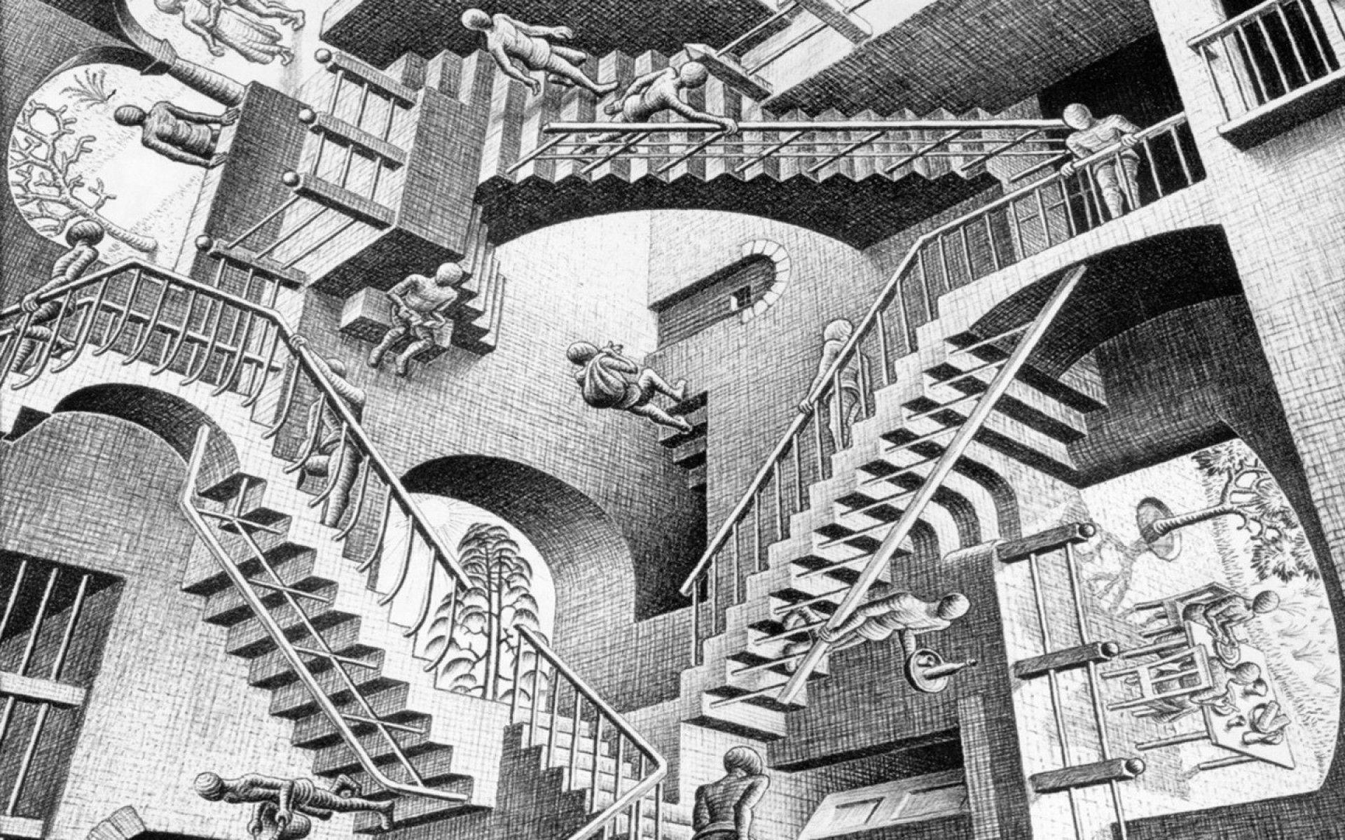
The colour began as an afterthought, but turned out to be a revelation. Many parishes have gained or lost townlands over the centuries and now consist of multiple separate areas. Colour makes the links between the various parts jump out. Have a look at Drumcolumb parish in Sligo, scattered in four distinct parts. Or my favourite, Shrule in Mayo, which incorporates a townland from the separate parish of Kilmainebeg, with that townland then incorporating a separate townland from Shrule. M.C Escher, eat your heart out.
The people of Shrule and Kilmainebeg go about their daily business
All of this was only possible because of the wonderful work of OpenStreetMap, in particular the mappers behind www.townlands.ie, who made all their data open-source. For some extraordinary work by one of the people behind that site, have a look at Brian Hollinshead’s astonishing www.dublinhistoricmaps.ie. It is Map-Nut Nirvana. Not only does it include every single map of Dublin ever published, all overlaid on contemporary street plans, it also includes some extremely useful guides, for example to local registrars’ districts. As well as some deeply odd ones: Dublin Compressed Gas Filling Stations?
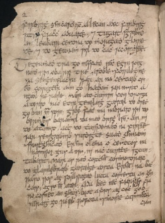
I never studied history academically. In fact, my last formal schooling in the subject ended at the age of fifteen. So, like all autodidacts, I have a certain twitchiness about the lacunae in my knowledge (I kept up the Latin). I’ve just finished Dáibhí Ó Cróinín’s Early Medieval Ireland 400-1200 (2nd ed. Longman, 2016), in an attempt to fill in some of the gaps. (Full disclosure: Dáibhí was a school friend of mine more than fifty years ago). The book isn’t always an easy read, though there some nice flashes of impish humour.
Puzzling and frustrating
What really shines is the treatment of sources. The second edition includes the best short account I’ve read of the potential of early Irish genealogies. These things are vast. Nothing on their scale exists anywhere else in the world, and they have puzzled and frustrated historians and genealogists for generations. The earliest surviving manuscripts date to the 1100s, but the historical individuals they cover go back to at least the fifth century, 600 years earlier, and of course the makey-uppy individuals go back to the Garden of Eden. They cover tens of thousands of families, some in biblical lists of “who-begats”, and others in great spreading collateral branches. But they include not a single date and are distorted by centuries of revision and rewriting, as one ruling family usurped another and needed to show their ancient legitimacy. So using them as historical or genealogical sources is almost impossible. Half may be true: but which half?
What the book does is show how it is (sometimes) possible to cross-reference a genealogy with some of the Irish annals, for example to identify a year of death and thus an entire extended family. This is not easy, to put it mildly, requiring fluency in Old Irish and Latin, familiarity with continental medieval manuscripts, and the patience of a saint, a constellation of qualities hard to find in one person. Step forward Dáibhí.
Not Dáibhí
Miraculously, the wonderful section on medieval sources is part of the free sample download on Kindle. Sorry Dáibhí.
A more general point I took from the book is the extent to which Gaelic Irish surnames encode the story of medieval Ireland. Yes, all of those names are patronymic, Ó, ‘grandson of’, and M[a]c, ‘son of’, in a way that shows just how important descent and genealogy was in Ireland when hereditary surnames began in the 10th and 11th centuries. But the stems of the surnames, the personal names of the individuals from whom descent is being claimed, embody a world that existed long before there were surnames.
There was a lot of fighting in that world. Warrior-derived surnames abound: Cath means ‘battle’, with the personal name Cathán meaning ‘battler’. Ó Catháin, ‘grandson of the battler’, arose in at many different areas and was anglicized as ‘Keen’ (Co. Down), as Kane and Keane (Cos Derry and Galway), as Kane in Mayo … That most Irish of all names, Murphy, in modern Irish Ó Murchú, comes from the personal name Murchadh, Mara, ‘sea’ and Cú, ‘hound’, so ‘sea-fighter’. There must have been a lot of them: the surname arose in at least seven different areas. The many other warrior surnames include Coakley, Conville, Donoghue, Dooley, Duncan , Falahee, Ganley, Glancy, Hanrahan, Hargy, Horohoe, Hourihane, Kemp, Kimber, Lambe, McCamley, McCann, Clancy, McDonagh, McEvilly, McKinley, McMurrough, Loane, Looney, Shanley, Staunton , Moraghan, Murchan, – all based on fighting.
The Vikings first came to Ireland at the end of the 8th century and left plenty of progeny bearing personal names that went on to become the roots of hereditary surnames: Doyle (Dubh Gall, dark foreigner, Danish apparently), Groarke (Hrothrekr, Norse), Higgins (Mag Uiginn, son of the viking), Loughlin (Ó Lochlainn, grandson of the viking), McManus (Mac Maghnuis, from Mánus, a Norse forename, Reynolds (Mac Raghnaill again Norse), Sugrue (Sigfrid), Beirne (Bjorn), Broderick (Brudar).
IrishGenealogy’s civil records section is the greatest thing since sliced bread. Almost single-handedly, it has revolutionised Irish family history research. By making almost 16 million births, marriages and deaths open and free, it also enabled whole fields of research – into infant mortality, townland history, occupational history – that had been closed books. So all hail IrishGenealogy.
Except (there had to be an “except”) … over the years, I’ve regularly noticed peculiarities in the site’s search results: the same search parameters sometimes bring back different results or the results include many more records than expected.
So, in the same spirit of enquiry that led me to dismantle Santa’s 1959 gift of a wonderful toy Winchester, I went down the rabbit-hole that is the IG search interface. Be warned. This gets geeky.
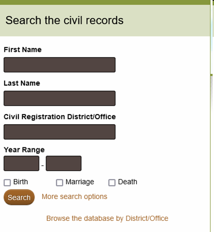
First the simple search: Enter a first name and a last name here and the site will search its forename records (and all forename variants) for that first name and search its surname records (and all surname variants) for the last name. But there is no way here to turn off the variant search. So entering “Jeremiah”, always also finds Darby and Jerry and Gerard and Gerald, entering Smith always also finds Smyth, Smythe, Smithe ….
In addition, for births after 1899, where the record includes the mother’s maiden surname, that surname and its variants are also searched. So a search for any “Sadler” born in 1900 also returns all births where the mother’s name is Sadler or Sadlier or Sadleir … There is no way to confine the search to the child’s surname only.
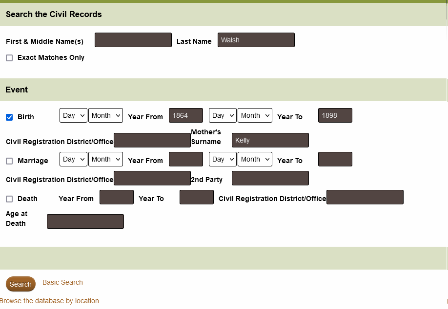
The innocuous-sounding “More Search Options” is even more complex, especially when searching on two names. The crucial distinction to keep in mind is between the names entered at the top of the page and any other names you enter for mother’s maiden name or spouse.
First, like the simple search, the main forename and surname boxes search only forenames and surnames. And again, for births the mother’s maiden name is always searched. Here you can turn off variants by ticking the “exact match” box, but this won’t turn off the mother’s maiden name search. So we have actually no way on the site to search just for a child’s birth surname.
The most important quirk in the “More” area is that variants are only ever applied to the main surname, not any other names you enter. So searching for a Walsh with mother’s maiden name Burke (after 1899) will find all Walsh/Welsh/Walch children with mother’s name spelt exactly “Burke”. No Bourk or Bourke or De Burca mothers.
This can be especially tricky with marriage searches. Again, variants are only applied to the two main names, not anything you enter in the “2nd Party” box. Search for a Derby Moriarty who married a McElligot and you’ll get all variants of Derby and all variants of Moriarty but only the exact spelling of McElligot. And I count at least 13 variant spellings of McElligot in the marriage records.
Because IG marriages cover more than a century, and because marriage records are the most useful of the BMD trifecta, the moral is clear: always reverse names and do a second marriage search, whether or not you think you’ve found what you want.
Finally, remember that wild cards are always usable in all the name boxes in the “More” area.