Remote and alien pagan babies. And 1916

One of the joys of genealogy is coming eyeball to eyeball with the past in all its weird particularity. It produces two apparently contradictory effects. On the one hand, you get to appreciate that a century ago (or twenty centuries ago) human beings everywhere were just as human as we are, with all the fears and desires that we have. On the other, you realise how alien and remote the past can be. It is just not possible to recapture what it felt like to live inside the elaborate warrior-dominated caste system of pre-medieval Ireland or to be forced out of a WW1 trench knowing you face instant, certain death.
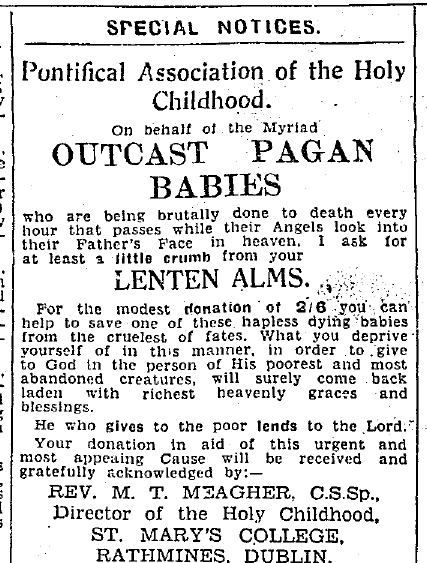
Alien and remote: Irish Independent Apr 1, 1939

So when I saw the tag-line for the GPO 1916 museum in Dublin – “So real you almost smell the gunsmoke” – my hackles rose. What about the smell of gangrene? Or the dead horses rotting out on Sackville Street? The museum (full title “The GPO Witness History Museum & Visitor Centre“) has won international awards, provides a nice day out and does what it does very well indeed. But what it does is provide immersion in a sanitised past, a theme park version of history carefully relieved of anything truly strange or upsetting.

This obligation to immerse seems to be part of a bigger trend in the leisure sector, of which history and genealogy are now minor branches. So 3D cinema is no longer enough, we’re now on to 4D. Which apparently involves splashing water on everyone when a boat appears, puffing out scent to accompany flowers and (one can only hope) eventually disembowelling an audience member live during ‘Halloween 39: Great-Grandson of Freddie’.

Immerse yourself

The Spanish Flu and Irish family history

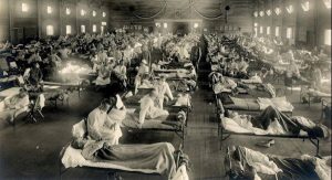
Over the course of 52 months, the First World War killed around 16 million people. In twelve months, the 1918/1919 influenza pandemic killed at least 50 million, and possibly twice that number. It was the greatest medical holocaust in history, destroying more lives in 24 weeks than AIDS in 24 years, and more in a year than the Black Death killed in a century.

Camp Funston, Kansas, 1918

Why does it not loom larger in our historical awareness? One reason is official suppression of its scale. Although the earliest known outbreaks were among US troops in Kansas and near Étaples on the Western Front, wartime censorship blocked  reports of the pandemic in the countries at war. Because Spain was neutral, the pandemic’s effects could be freely reported. As populations sickened and died, they heard more about the effects in Spain than in their own countries. Hence “Spanish Flu”.

In Ireland, it came in three waves. The first recorded outbreak was on the troop carrier the USS Dixie off Cobh in May. That early wave was relatively mild – those who survived acquired immunity to the two later waves. The most lethal of these came in November 1918, just as the War ended, and a last, less deadly wave arrived in spring 1919.

What does any of this have to do with genealogy? One of the great successes of recent genealogy in Ireland has been to recover, family by family, the suppressed histories of the Irishmen who fought in the First World War. Perhaps something similar needs to be done for those who died in the Spanish Flu.

The tools are already at our fingertips and perfectly adapted. The civil death records on IrishGenealogy provide detailed causes of death, day by day, district by district, and can be minutely examined using the site’s “more search options“.

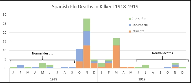
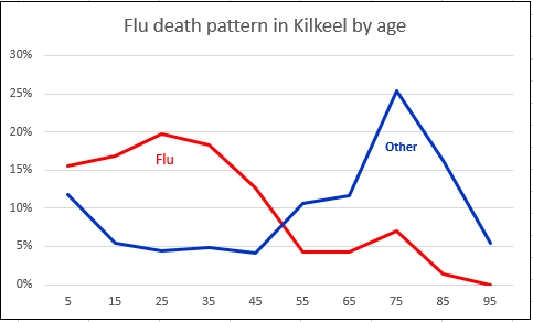
An example of what can be done by a local historian is Dermot Balson’s brilliant work on Kilkeel in Down. His two charts, based on these death records, show just how brutally the flu impacted on the area between October 1918 and March 1919, and how young adults died disproportionately.

A single page from the death registers of Athlone No. 1 district between December 12 and 19 1918 shows why a genealogist might also be interested. Out of the ten deaths listed, nine are influenza related. And the second last is the death of my grandfather’s first wife at the age of 30. He remarried two years later, to my grandmother.


More maps than you can shake a stick at

Like everyone involved in Irish genealogy and local history, I spend a lot of time looking at Griffith’s Valuation on askaboutireland.ie. Griffith’s is the only Ireland-wide census substitute for the mid nineteenth century and the site is wonderful, not least because it is free.

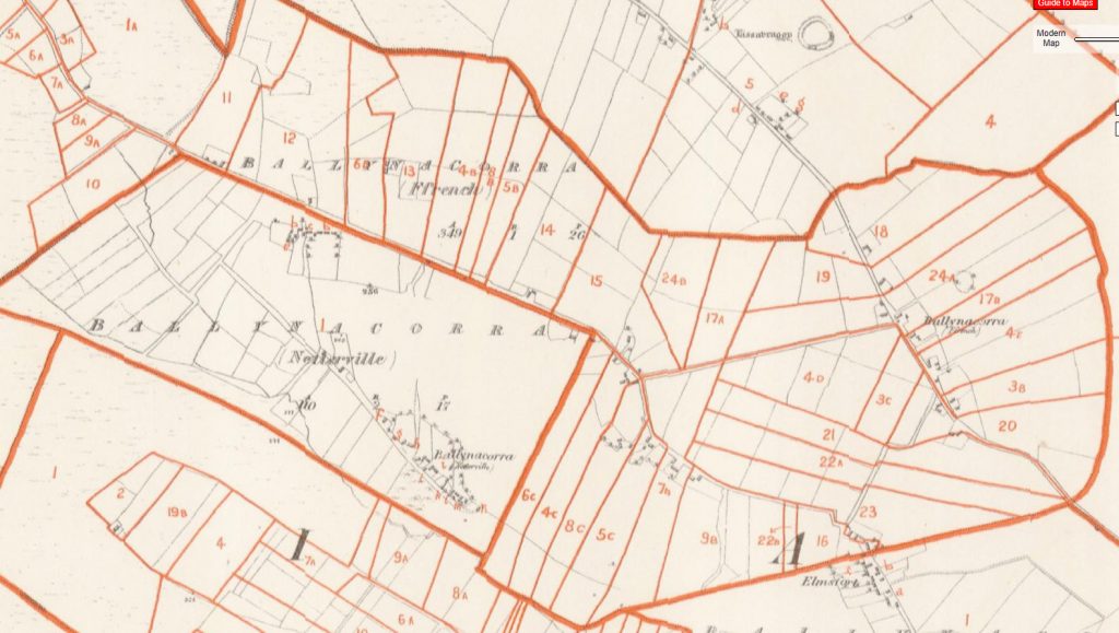
One feature, though, has caused much grief to users over the years, the mismatch between the printed records and the maps that accompany and supposedly illustrate them. The maps used on the site date from several decades after the publication of the Valuation, and so can differ starkly from the printed original.

More than 20 years after the published Valuation

The reason is that Griffith’s was a live property tax survey. So for a century and a half the Valuation Office had to record changes in occupier, holding size, lessor – anything that could affect the value of a holding and thus the tax to be paid on it. Handwritten, copybook-style versions of the original were used to list the changes, which were then hand-marked on the Office’s own copies of the six-inch Ordnance Survey maps.

The wonderful little slider

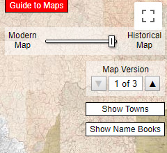
The main maps used by askaboutireland consist of one full baseline set of these map revisions, dating from the late 1870s, more than two decades after the publication of the books. It has to be said that the mismatch between printed books and maps is more than made up for by the layering of the maps over contemporary Google maps and satellite images.  Their wonderful little slider makes it possible to move back and forth between the 1870s and today, with detail right down to the level of individual fields and streets. Many users find themselves entranced: “What, 4 a.m. already?”

But these are not the only maps on the site. Every single working revision map from the Valuation Office (Republic of Ireland ony) now appears to be there, layered one over the other, with up to eight separate maps for some areas. And no way of telling which follows which.

How to use them? When the full handwritten revision books eventually become available online, it may be possible to date the maps by comparing them with the written records, though most of the VO maps lack the lot outlines of the main series that would make such connections possible.

Be reassured: it’s not just you. Everyone is floundering.

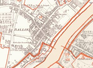
Ballina on the VO five-foot map

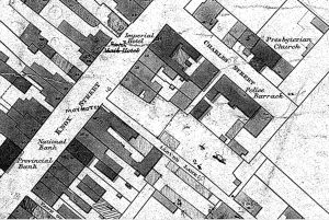
For the moment, by far the most useful of these are the VO town plans. These are part of a series of more than 1400 maps drawn up by the Ordnance Survey specifically for Griffith, at the phenomenal scale of five feet to the mile, ten times more detailed than the OS main series. Though also undated, they do include lot and house numbers, making it possible to follow the fate of every building in every street.  They should be top of every Irish local historian’s to-do list.

Ballina on the OS six-inch