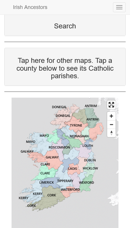
We just put up much-improved maps of the Catholic parishes of Ireland, the usual all-singing, all-dancing, zoomable, click-through, will do your laundry on request, with a nice auto-complete search. Have a gander.
 Nice though they are, that’s not what this post is about. I want to confess where the maps came from.
The clicky, zoomy part comes from the National Library of Ireland’s parish maps, available for free as part of the government’s open data policy. Ta very much.
But where did NLI get the maps?
They got them from me. When planning to digitise the parish register microfilms, they asked to use the maps published in Tracing your Irish Ancestors and (at that time) on the Irish Times site. I said yes and provided advice and they picked up on some of the mistakes in the maps for me to correct. Win-win.
But where did I get the maps?
Shuffles. Looks at shoes. Back in 1991, when I was putting together the first edition of the book, I thought a killer selling point would be Catholic parish maps. Nothing like them existed, at least not for the entire island, and I knew from bitter experience that trying to work out the position of adjoining Catholic parishes one-by-one by using the underlying civil parishes was frustrating and headwrecking and not always possible.
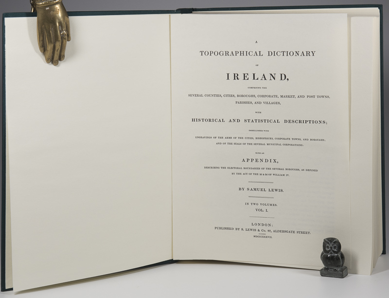 But the only nineteenth-century source for the geography of Catholic parishes was and is Samuel Lewis’ Topographical Dictionary of Ireland (1837). Lewis was resolutely Anglican and his coverage of Catholic parishes could be a tad grudging, with offhand comments along the lines of “the [civil] parish is divided between the two RC parishes of Ballythis and Ballythat”. And sometimes he just ignored the bloody papists altogether.
To be fair, for most papist Catholic parishes Lewis does give clear enough direction, making it possible to use existing civil parish boundaries to trace the Catholic outlines. But for around thirty per cent or so, there is no clear direction.
What to do? Once you start to draw the things, it becomes clear from the gaps where some parishes must be. But for those incorporating parts of multiple civil parishes, it’s just not possible to say with any accuracy where inside those civil parishes the Catholic border should go.
After wrestling with my conscience and winning, I simply took my pencil and drew lines where they looked most probable. As a salve to my sulking conscience, the original published maps came with loud disclaimers, saying they were not geographically precise and were there only to show the positions of parishes in relation to each other. Somehow the disclaimers fell off the back of the lorry transporting the maps to NLI.
Hence my enduring reluctance to overlay the RC maps on the townland maps.
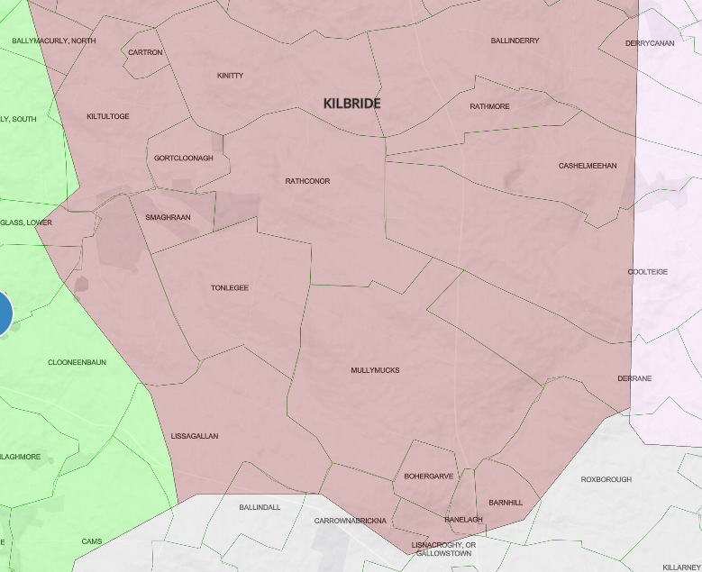
But I’ve just done it anyway. If you want to get a sense to just how geographically arbitrary some of the boundaries can be, have a look at a new feature, in beta, that takes RC and civil parish maps and allows you to swipe between them and zoom in on the underlying townlands. Here’s Tipperary for example, civil to the left, Catholic to the right. I promise, the more you zoom in, the more your hair will stand on end.
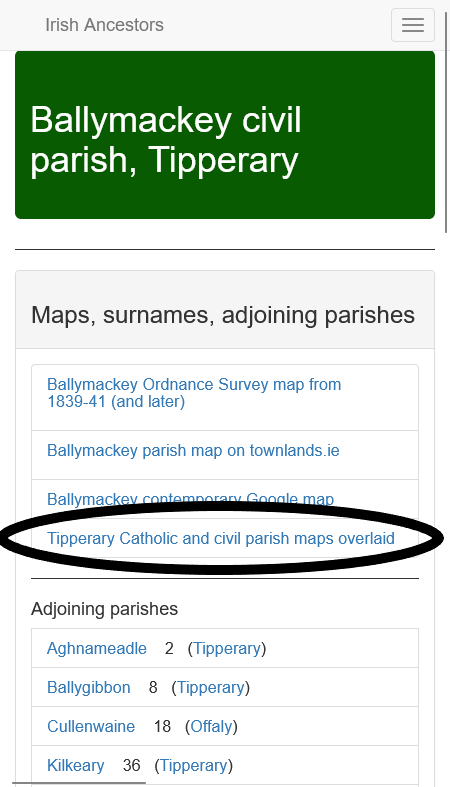 The swiping maps are tucked away discreetly in the individual civil parish pages, in the “Maps, surnames, adjoining parishes” section.
For the record:
WARNING!
NOT GEOGRAPHICALLY PRECISE!
SHOULD ONLY BE USED UNDER THE SUPERVISION OF A QUALIFIED SCEPTIC!
That will cost you a dozen Hail Marys…..
and an Act of Contrition…
Too funny, Dermot!
I love the new maps, I used to get very confused toggling between records with mis-spelt townlands, the old RC parish maps, and precise mapping web sites like townland.ie, so it’s so much easier now. One question: where do we find alternative parish names now?
You ARE the best- thank you! This is the time for full disclosure everywhere!
That explains why, at about 4am Dublin time this morning, as I tried to match a screen grab from your site of Mullagh parish that seemed to have some”geographic anomalies” I hadn’t noticed before. But what does “geographically precise” mean anyway when we live in a digital world where real landscape features are reduced to 0’s and 1’s today to enable us to use maps created hundreds of years ago by the surveyors of a conquering army in order to parcel up the land amongst themselves? And I’m certain our native ancestors rarely referred to such maps or relied much on them to know where they belonged. So don’t worry too much, my son, you may go forth knowing you have done great service to today’s genealogical searchers, your conscience is clear, maps are never geographically accurate, they’re useful approximations to the real thing only, and keep on with those prayers, you’re surely forgiven.
THANK YOU!
This is wonderful. Thank you.
Enjoy your sense of humour too!
Regardless of any errors and very educated guessing, these maps are literally a Godsend. Thank you for your years of dedication and work. Without your work I would not have been able to document my ancestors lives.
John, confession is good for the soul. You’re starting the New Year off right!
John, I love reading your missives. Couldn’t help but have certain lyrics pop in my head as you bemoaned the “civil to the left, Catholic to the right…” beta feature. From 1972… “clowns to the left of me, jokers to the right… here I am, stuck in the middle with you…” (Stealers Winde, Stuck in the Middle With You). Looking forward to swiping!
Love this! Glad to know I’m not the only crazy in town…
I remember pointing out to the local parish priest many years ago that some areas of the parishes of Glinsk and Ballintubber & Ballymoe on the Galway-Roscommon border were sometimes in one parish and sometimes in the other. His reaction was that could well be, nothing would surprise him about those records and, in fact, nobody seemed to be able to keep proper records there till well into the 20th century. And those records are far from being the worst I have come across.
Thanks, John, for doing the original work which no one seems to have bettered yet. You’re always helpful with a healthy dose of scepticism thrown in.
I will no longer beat myself up for any mistakes I made, writing which Civil parish was in which Catholic parish, after overlaying paper copies of the Civil and Catholic parish on a light box.
Wow John, that is so useful. I have done battle with Catholic Parish Records in the south of Leitrim. The little town I am interested in, Rassaun, is literally in walking distance of 4 catholic parishes, let along across the border to Longford – no wonder I have been bamboozled! Now I know I must expand the search.
Thanks heaps.
Theresa
As far as I’m concerned, this fills a MAJOR gap in pre-1900 Ireland genealogical map resources, even if imprecise. Thank you x 10^6! For me, one major use is narrowing down the possible townlands of residence for my ancestors based on the existence of records for them in a particular Catholic parish. I know precision is impossible, but would it be safe, for example, to deduce that if there are records in Tibohine R.C. Parish, Co. Roscommon, then the folks in question did NOT live in Ballinphuill townland, but might have lived in Carrowgarve or Lissacurkia? Thanks again. 🙂
Oh my stars! Your Tipperary example (thanks, it includes my family parishes; I knew we had a special relationship after all) finally makes sense of the records I’ve found. I think you’ve helped me solve decades long mysteries. At risk of personal embarrassment, I’ll ask again, are you already married? Thanks a million for all you do John. You help so many people.
Can’t we just paint a dark, black line all across the Island, take some pictures and upload to Google maps? That would fix all the problems! Please mention me when you put this on your website, John.
Tom
Like Joan I was copying the maps and overlaying them. This is sooo much better thank you !
I have ancestors from the townland of Farnane Lower in the civil parish of Lickoran, Co. Waterford. The records I found for them from the earlier 1800s were in Modeligo RC parish on RootsIreland.ie. The map shows the townland in Tooraneena. Rootsireland.ie records for Tooraneena don’t start until 1850. Is it possible the Tooraneena parish wasn’t formed until 1850 and the area was part of Modelligo parish until 1850 ?
Are there records of when a parish was started ?