Poor Law Unions are the geographical areas used to collect records of births, marriages and deaths in Ireland. They are still today, astonishingly, based on the old Victorian welfare system. Of course we had to map them.
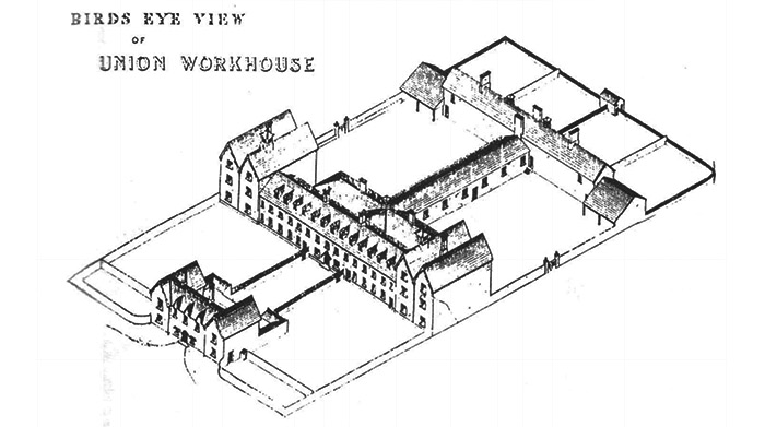
The Irish Poor Law Act of 1838 divided the island into 130 districts, each with a workhouse at its heart, usually situated in the largest local market town. A property tax was levied to pay for the operations of the workhouse, so the primary rationale for the area covered was that it should produce the necessary tax take. As a result many Unions ignored existing parish and county boundaries, unlike their English equivalents.
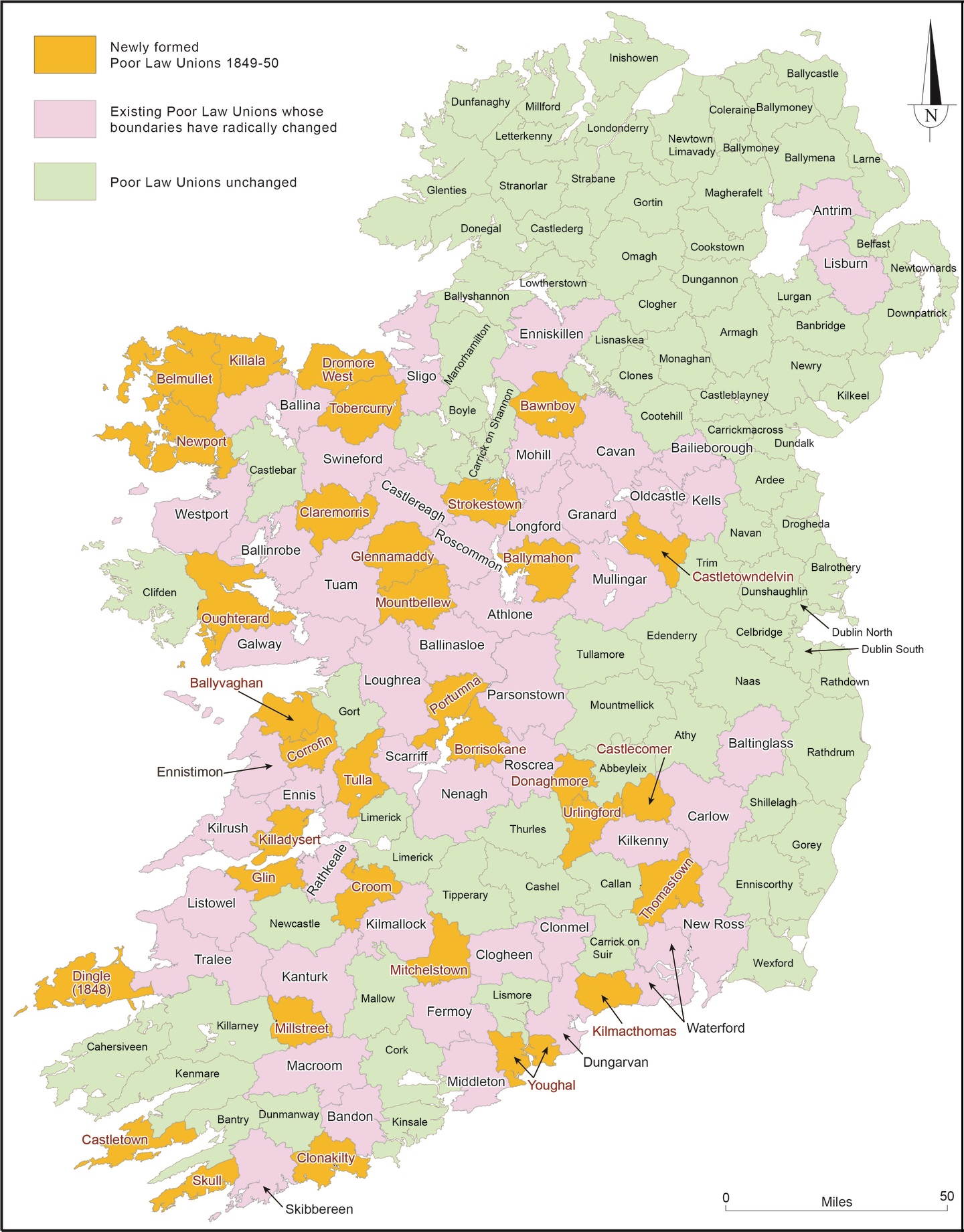
By 1852, the Famine had pushed the system to breaking point and new Unions were carved out of the existing districts, particularly in the south and west, where public hunger and distress had been at their most intense. For Irish genealogy, the direct relevance of the Poor Law begins in 1864, when the Victorian public health system based on the Unions took on state registration of births, marriages and deaths. A typically rigid hierarchy ran the whole thing. Local registrars collected registrations in subdivisions of the Union and passed them to the Superintendent Registrar in charge of the each Union, who made copies and passed them on in turn to the Registrar General in Dublin.
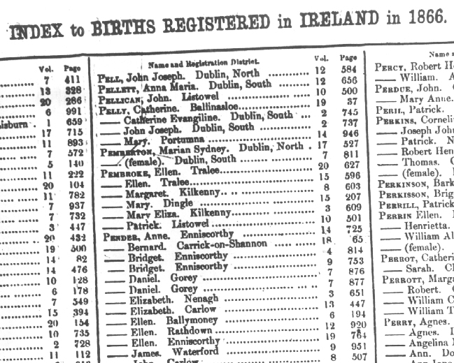
When centralised annual indexes were created by the Registrar General for all Irish births, deaths and marriages, the Poor Law Unions were the placenames used in the indexes: they are the locations that appear in the indexes online at IrishGenealogy and FamilySearch. Because most of them cover cross county and parish boundaries, they can be very deceptive.
Egregious examples: Edenderry Union includes parts of counties Kildare, Meath and Offaly, even though Edenderry town is 100% Offaly. New Ross, in Wexford, also covers bits of Carlow and Kilkenny. Ballyshannon takes in equal parts of counties Donegal, Leitrim and Fermanagh, Waterford Union includes most of south Kilkenny …
The point is that the system makes it all too easy to search for your ancestors in the wrong location. Hence the maps.
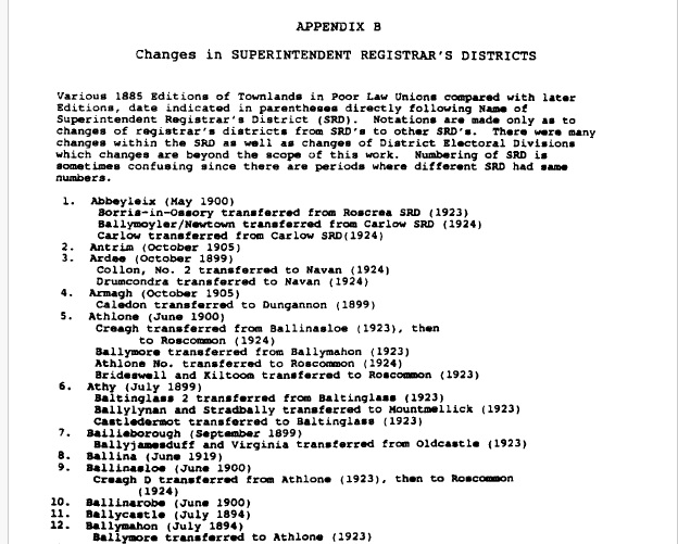
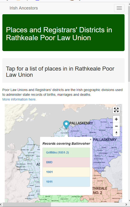
The townland lists used on to create the maps come from a marriage of the 1851 Townlands Index to the 1885 collection of pamphlets Townlands in Poor Law Unions, produced by the Registrar General to let local registrars know which areas they were responsible for. The pamphlets were collected and republished in book form in 1997 by the late, great George Handran, and republished on CD-ROM by Eneclann in 2006. There were significant changes and reoganisations of the local registrars’ districts over the years, with most of them detailed in George’s book. Dissolved unions (for example, Donaghmore) are identified on our maps, but all of the maps have to be taken as snapshots of an evolving system. Again, George supplies all the nitty-gritty.
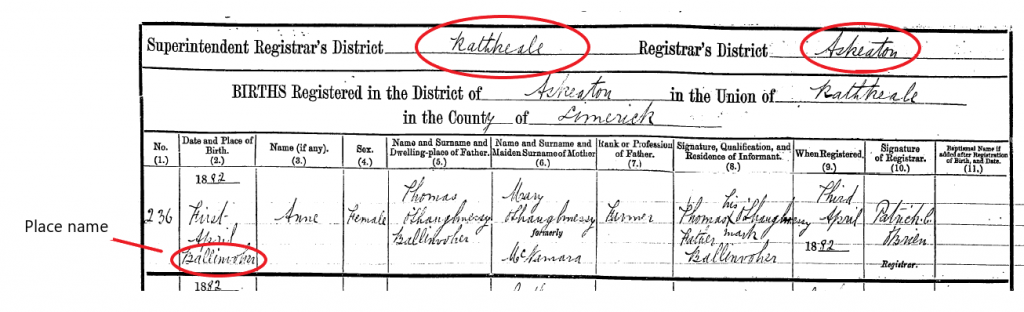
The usefulness of having searchable place names from the the Superintendent Registrar’s Districts and the local registrars’ districts lies mainly in identifying the places given in the original registrations. Standard spellings were not used and the handwriting can be fiendish. All registrations include both PLU and local registrar’s district, narrowing the possibilities. An example:
John,
Great post and I love the new maps. These add excellent context to each birth, marriage and death record registration page we access.
Dan
Great article John and thanks for selecting my old townland of Ballinvoher for your example. Three families there; all gone now.
Hi John,
Very helpful info!!!! For some reason, I never figured out that the registration offices were linked to the PLU. On the other hand, I may have figured it out and forgotten! Another problem occurs in later years when people started dying in the hospital instead of at home. It took me a long to time to figure that out too but I probably would have known if I had read all your blogs! Now that I know, I look for records in Birr and Tullamore just in case one of my Offaly relatives died in the Birr or Tullamore hosptitals. As you mentioned, the records can be difficult to read. In addition, they don’t always list the person’s home townland.
Great job, John. As always. Going into my home Registration District, and its neighbours, I would dispute the odd road name but that is a minor detail and I was surprised at all the other things I found that I was not aware of. But overall, a great achievement. What can be a very tedious subject to explain suddenly comes to life.
Thanks, John.
Your words should be written 100 times by novice Irish family researchers: “Unions were the placenames used in the indexes: they are the locations that appear in the indexes online at IrishGenealogy and FamilySearch. Because most of them cover cross county and parish boundaries, they can be very deceptive.” I have seen so many trees with the wrong townlands.
Thank you again, John. You produce consistently amazing work.
Love the new maps. .. have clicked on the BMD hyperlink but 10 minutes later the “I am not a robot” gateway into the Irish Genealogy website is still circling round and round.