| Accompanying Lewis map for Down 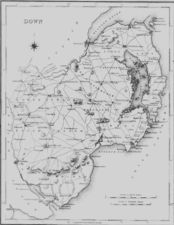
|
| BALLYMACARRETT |
| BALLYMACARRETT, a town and parish, forming part of the suburbs of BELFAST, in the barony of UPPER CASTLEREAGH, county of DOWN, and province of ULSTER; containing 5168 inhabitants. This place, previously to 1825, was simply a townland in the parish of Knockbreda, or Bredagh, and in the history of the county, published in 1744, is described as containing only two buildings, Mount Pottinger and a mill. It is now become a populous and flourishing town, occupying a site formerly covered by every tide, but which has been reclaimed by an extensive embankment stretching from Conswater westward to the river Lagan, opposite to the quays of Belfast, and thence on the shore of that river to Ormeau, the splendid residence of the Marquess of Donegal. The town, which in 1831 contained 257 houses, forms an appendage to Belfast, from which it is separated only by the river Lagan, which here separates the counties of Down and Antrim, and over which is a stone bridge of 21 arches: it is irregularly built, but has been greatly improved by the formation of several new streets ; and a handsome bridge of five arches, about 400 yards above the long bridge, and opening a more direct communication with the southern part of Belfast, has been lately erected under an act obtained in 1831, at an expense of £6000, raised in transferable shares of £25 each. The first manufacture established here was that of glass ; and since the first glass-house was built, in 1776, two other extensive establishments have been erected, though at present only one is in operation. A pottery upon a very large scale was soon afterwards established; and previously to the removal of the duty on salt, there were two extensive works for the manufacture of that article from rock salt brought from England, for exportation, which are now discontinued. The Lagan foundry, for the manufacture of steam-engines and other machinery on the most improved principles, affords employment to 140 persons: and in 1832 the first patent machine for making paper ever introduced into Ireland was made at these works. A very extensive rope-yard and sail-cloth manufactory, affording employment to 130 persons, are carried on; and two large vitriol works, of which one, established in 1799, was the second erected in the kingdom, are in full operation for supplying the bleachers, dyers, and calico printers in the neighbourhood. There are also extensive starch-manufactories, and meal and flour-mills driven by steam and water; and two large mills for spinning linen yarn were erected in 1834, and employ more than 300 persons. The manufacture of calico and muslin is carried on upon a very extensive scale, affording employment to several hundred persons. Here is a constabulary police station. This place was erected into a parish by an act of the 12th of Geo. III., and comprises 575 statute acres, which are exempt from tithes; about 28- acres are under water, and the remainder are arable and pasture. The living is a perpetual curacy, in the diocese of Down, and in the patronage of the Rector of Knockbreda: it is endowed with the tithes of Ballynafeigh, an adjoining townland, amounting to £50, which is augmented from Primate Boulter's fund. The church, a neat building, was erected in 1826 by aid of a grant of £800 from the late Board of First Fruits and by subscription. In the R. C. divisions the parish forms part of the union or district of Belfast, in the diocese of Connor; the chapel was built in 1829. There are places of worship for Presbyterians in connection with the Synod of Ulster and the Seceding Synod, and for Covenanters and Wesleyan Methodists. There are five schools in which about 298 boys and 182 girls are instructed; also three pay schools, in which are about 90 boys and 50 girls. |
| Belfast (Part 1) |
| BELFAST, a sea-port, borough, market-town, and parish, partly in the barony of LOWER, but chiefly in that of UPPER BELFAST, County of ANTRIM, and province of ULSTER, 8 miles (S. by W.) from Carrickfergus 13? (S. E. by E.) from Antrim, and 80 (N.) from Dublin; containing, in 1821, 44,177, and in 1831, 60,388 inhabitants, of which latter number, 53,287 were in the town and suburbs, and 48,224 in the borough ; and within three years after the latter census the population of the parish had increased nearly 7000 more. At a very early period this place obtained, according to some writers, the appellation of Beala-farsad, which has been supposed to signify "Hurdles-ford town," and according to others that of Bela-fearsad, "the town at the mouth of the river ;" which latter is accurately descriptive of its situation on the river Lagan, near its influx into the lough or bay of Belfast. But, perhaps, a still more probable conjecture is that which ascribes its etymology to the Irish Ball-Fosaght, signifying "the town with a ditch or foss," which, from its low situation, were anciently constructed round the town, to protect it from the tide. Previously to the English conquests in the province of Ulster, it appears to have been a fortified station commanding the passage of the river, which is here fordable at low water, and important also from its position on the line between the ancient stations of Carrickfergus and Ardes, respectively in the counties of Antrim and Down, between which the Lagan has ever been regarded as the boundary. The original fort, of which the site is now occupied by St. George's church, was taken and destroyed about the year 1178, by John de Courcy, who soon after erected a noble castle on a more eligible spot. King John marched his army to this place, in 1210; but no notice of any town occurs till the year 1316, when the destruction of the town and castle by Edward Bruce is recorded. The Irish chieftains, having by his aid recovered their ancient possessions, rebuilt the castle, of which, through the intestine divisions in England and their union with the English settlers in Ulster, they kept uninterrupted possession for nearly two centuries, till the reign of Hen. VII., when the Earl of Kildare, at the head of a large army, in 1503, took and destroyed the town and castle; but the latter was soon afterwards repaired by the native chieftains, from which, however, their forces were again driven by the earl, in 1512, and compelled to retire to the mountains. From this period Belfast remained in a ruined and neglected state, till the year 1552, when Sir James Crofts, lord-deputy, repaired and garrisoned the castle; and during the same year the Irish of Ulster again appeared in arms, under the command of Hugh Mac Nial Oge, but the English government offered terms of accommodation which that chieftain accepted, and, swearing allegiance to Hen. VIII., he obtained a grant of the castle and town of Belfast, with other extensive possessions. After the death of Hugh, who was killed in 1555 by a party of Scottish marauders, his possessions passed to other branches of his family, with the exception of the castle, which was placed in the custody of Randolph Lane, an English governor; in the lath of Elizabeth it was granted, with its extensive dependencies, to Sir Thomas Smythe and his son, on condition of their keeping a certain number of horse and foot in readiness to meet at Antrim after a brief notice) to attend upon the lord-deputy. In 1573 the Earl of Essex visited the fortress, which the Irish had previously, on different occasions, frequently attempted to take by surprise; and in 1575 the Lord-Deputy Sydney encountered the Irish forces at the ford of this place. About that period, Belfast is said to have had a forest and woods, of which all traces have long since disappeared. After the death of Elizabeth, the garrison, influenced by Hugh O'Nial, Earl of Tyrone, refused submission to the English crown; but, on the defeat of that powerful leader and his adherents, the English gained the ascendency, and Sir Arthur Chichester, lord-deputy in the reign of Jas. I., issued his summons requiring the supplies of horse and foot, according to the tenure by which the castle was held; and no one appearing in answer to this requisition, the castle and demesne became forfeited to the crown, and were given to Sir Arthur in 1612. |
| Belfast (part 2) |
| The Chamber of Commerce was originally established in 1783; its meetings were suspended from 1794 to 1802, since which time they have been resumed without interruption, greatly to the benefit of trade and the interests of the town. The Old Exchange, situated nearly in the centre of the town, at the end of Donegal-street, is the private property of the Marquess of Donegal; it was formerly the place of public resort for the merchants, but, since the erection of the Commercial Buildings, has been used only for the election of the chief magistrate. The Commercial Buildings were erected in 1822, opposite to the Exchange, at an expense of £20,000, by a proprietary of 200 shareholders incorporated by act of parliament in 1823, and by a committee of whom, annually elected, the affairs of the institution are conducted: the buildings comprise an excellent commercial hotel, a spacious and handsome news-mom, over which is an elegant assembly-room, and behind these an area with a piazza for the use of the merchants; and in connection with them are numerous offices principally occupied by professional men. The north front, of Irish granite, is decorated with eight lofty Ionic columns, and the west front is principally occupied by shops: the merchants assemble in the news-room and hold 'Change on Monday, Wednesday, and Friday. The revenue derived by Government from the post-office, in 1835, was £10,073. The banking establishments are the Northern Banking Company, established in 1824; the Belfast Banking Company, in 1826; and the Ulster Banking Company, in 1836 : all have branches in the different large towns throughout the province. There are also branches of the Bank of Ireland, the Provincial Bank, and the Agricultural and Commercial Bank of Ireland. |
| KNOCKBREDA |
| KNOCKBREDA, or KNOCK-with-BREDA, a parish, partly in the barony of LOWER, but chiefly in that of UPPER CASTLEREAGH, county of DOWN, and province of ULSTER, 2- miles (S. S. E.) from Belfast, on the road to Downpatrick ; containing 3900 inhabitants. The ancient fortress called CastleReagh, or "the royal castle," which gives name to the barony, was formerly the baronial residence of a branch of the O'Nials. It is said to have been erected in the reign of Edw. III. by Aodh Flann, whose descendants possessed the Great Ardes, Toome, Massereene, Shankill or Belfast, and Carrickfergus. By inquisition in the reign of Elizabeth it appeared that Con O'Nial, the last of that powerful sept, possessed this castle, together with 224 townlauds, which were all freehold, and also many others held by various tenures. In 1602, O'Nial having exhausted his cellars during a grand banquet which he gave here, sent some of his soldiers to Belfast to procure more wine ; and there meeting with a party of the Queen's soldiers, a battle ensued, and O'Nial was sent prisoner to Carrickfergus castle, but was liberated the year following by the master of a Scottish trading vessel and conveyed to Scotland, where Sir Hugh Montgomery, in consequence of a surrender of most of his lands, obtained a pardon for him from Jas. 1., who had just ascended the English throne. After the decease of O'Nial, the castle fell into decay, and with the adjoining lands was purchased by the Hillsborough family ; there are now no vestiges of it. The parish is bounded on the north and west by the river Lagan, over which are two bridges connecting it with the parish of Belfast, and is intersected by the great Scottish road by way of Donaghadee. It comprises, according to the Ordnance survey, 8098- statute acres, of which 6968- are in the Upper and 1129- in the Lower barony ; the lands are chiefly under tillage, and in a high state of cultivation ; there is neither bog nor any wasteland. Large quantities of tobacco were grown previously to its cultivation being prohibited. There are extensive quarries of clay-slate for building and for repairing the roads ; and on the townland of Gillinahirk has been opened a fine quarry of basalt, of which a bridge is now being built at Belfast over the river Lagan, which is navigable along the whole boundary of the parish. The surrounding scenery is richly diversified, and within the parish are Ormean, the seat of the Marquess of Donegal ; Belvoir Park, the residence of Sir R. Bateson, Bart. ; Purdysburn, the splendid mansion of Narcissus Batt, Esq., built after a design by Hopper, in 1825, in the Elizabethan style ; Orangefield, of J. H. Houston, Esq. ; Fort Breda, of W. Boyd, Esq. ; Cherry Vale, of J. Stewart, Esq. ; and Ravenhill, of H. R. Sneyd, Esq. Previously to 1658 there were two separate parishes, called respectively Knock and Breda, both rectories ; but the church of the latter being in ruins, they were united into one rectory at the restoration of Chas. II. The two villages have long since disappeared, and a parish church was, in 1747, built in the village of Newtown-Breda, which see. The rectory is in the diocese of Down, and in the patronage of Sir R. Bateson, Bart., who purchased the advowson in 1825 ; the tithes amount to £586. 5. 7-. The glebe-house was built in 1816, by a gift of £100 and a loan of £825 from the late Board of First Fruits: the glebe comprises nearly 20 statute acres. The chapel of Ballymacarrett was formerly in this parish, from which that townland was separated by act of parliament in 1825, and made a distinct parish. There are places of worship for Presbyterians in connection with the Synod of Ulster, Covenanters, and Seceders. About 130 children are taught in three public schools, of which one is supported by Mrs. Blakeston ; and there are five private schools, in which are about 170 children, and four Sunday schools. Six almshouses, built by subscription in 1810, are endowed with £100 by the Rev. Mr. Pratt, late rector, who also bequeathed £100 to the poor, to whom Lady Midleton, in 1747, left £50. On an eminence near the south-eastern extremity of the parish are the picturesque ruins of Knock church ; and near them are the remains of a cromlech, consisting of five large stones, and a Danish rath of conical form. Of Breda church there are no remains, except the cemetery enclosed with a high stone wall in Belvoir park, in which is a small mausoleum built by Arthur Hill Trevor, who was created Viscount Dungannon in 1765. |
| NEWTOWNBREDA |
| NEWTOWNBREDA, a village, in the parish of KNOCKBREDA, barony of UPPER CASTLEREAGH, county of DOWN, and province of ULSTER, 2 miles (S.) from Belfast, on the road to Saintfield ; the population is returned with the parish. It is pleasantly situated on an eminence near the river Lagan, and immediately adjoining Belvoir Park, the seat of Sir R. Bateson, Bart. ; it consists chiefly of small detached white-washed cottages, with gardens in the rear, which give the village an extremely interesting appearance. It is a station of the constabulary police ; and petty sessions are held on alternate Saturdays, Fairs are held on July 5th, and Oct. 27th, Here is the parochial church, a small but elegant edifice in the Grecian style, erected in 1747, under the direction of Mr. Cassels, by the Viscountess Dowager Midleton. The burial-ground, which is the cemetery of several of the most respectable families of the surrounding country, has a very neat and interesting appearance. |
|